

Tampines Expressway | My Take on Speed Limits, Traffic & Map
When I first started learning my way around Tampines, I quickly realised that understanding the roads is just as useful as knowing the MRT stations and bus interchanges. Tampines is a large town, and when you’re moving between different parts of the east, the expressway network can make a noticeable difference to how you plan a journey. The Tampines Expressway, or TPE, was one of the roads I kept seeing while researching how Tampines connects with neighbouring areas. What interested me most wasn’t simply its length or construction history, but the role it plays in connecting the eastern and north-eastern parts of Singapore.
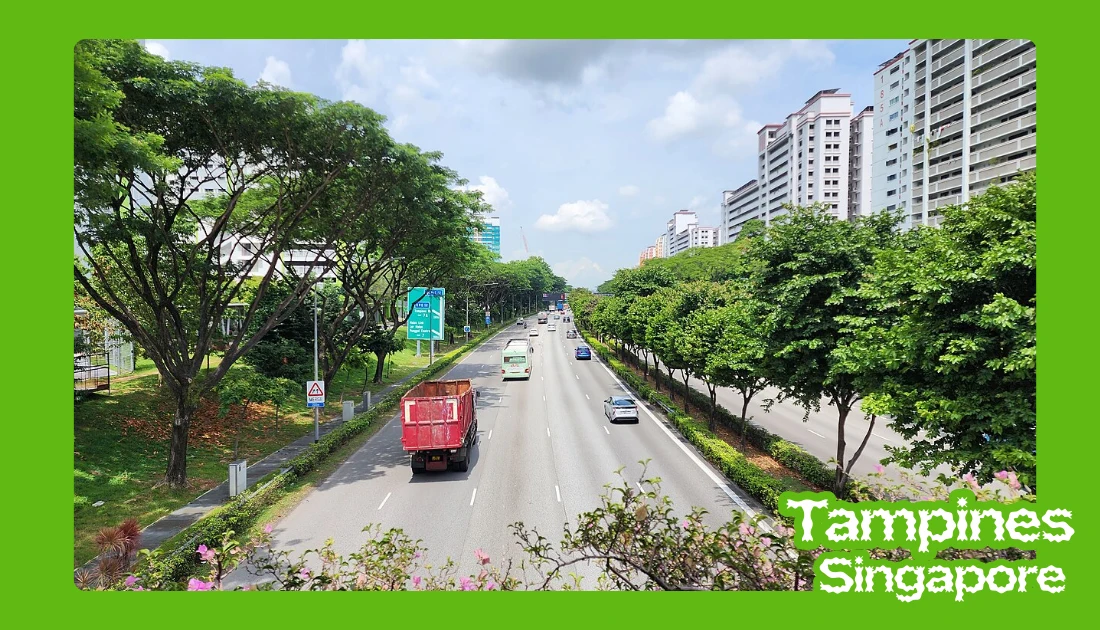
The Tampines Expressway is a major highway on the north-eastern fringe of Singapore, forming a critical east-west transport corridor across the island. It links the Pan Island Expressway (PIE) near Changi in the east to the Central Expressway (CTE) and Seletar Expressway (SLE) in the north. For residents of Tampines, Pasir Ris, and Punggol, TPE is one of the primary expressways used for daily commuting.
- Constructed: September 30, 1987
- Length: 14 km
- East end: Changi (PIE)
- History: First section completed in June 1989, last section completed in August 1996
- West end: Seletar (CTE, SLE)
Overview of Tampines Expressway
TPE begins near Changi, where it connects to the Pan Island Expressway, and runs westward toward Seletar, linking directly to both the Central Expressway and the Seletar Expressway at its western end. This configuration makes it a strategic connector between eastern Singapore and the northern expressway network.
Along its 14 km route, TPE serves several mature and developing residential towns, including Tampines, Pasir Ris, Punggol, and Seletar, supporting commuter flows between these estates and employment zones such as Changi Airport and the industrial areas near Defu and Seletar Aerospace Park. Key junctions include the interchange with PIE at the eastern end and the connections to SLE and CTE at the western end, along with the Defu Flyover linking TPE to Airport Road, an important junction for industrial and airport-bound traffic.
I think this is particularly useful to know if you’re visiting Tampines from somewhere else. Depending on where you’re coming from, TPE connects into the wider expressway network, giving drivers access toward areas around Changi, Pasir Ris, Punggol, Seletar, and beyond. It also helped me understand why traffic conditions in this part of Singapore can feel quite different depending on the direction and time of day.
Traffic and Driving Conditions
Traffic on TPE varies depending on direction and time of day. Morning peak congestion typically builds toward the PIE and airport-bound sections, while evening traffic tends to intensify toward the SLE and CTE, with interchange merging points being common bottlenecks due to lane consolidation and higher vehicle volume.
Accidents on TPE, including occasional serious incidents, tend to be concentrated near merging zones and during wet weather. Sudden braking and high traffic density contribute to rear-end collisions, and while large-scale structural incidents are rare, any reported accident can noticeably disrupt traffic flow across the north-east corridor.
One thing I’d keep in mind is that an expressway isn’t necessarily the quickest option at every moment. Peak-hour traffic, merging lanes, roadworks, weather, and incidents can all change the journey. If I were driving somewhere unfamiliar, I’d check live traffic conditions before setting off rather than relying only on the usual journey time shown on a map. Drivers are generally advised to monitor real-time updates through official platforms such as the Land Transport Authority (LTA) and navigation apps, maintain safe following distances, reduce speed during rain, and avoid abrupt lane changes near interchanges and flyovers.
I’d also give the weather its own attention. Singapore’s rain can arrive suddenly, and wet roads change driving conditions quickly. I’d rather allow a little extra time and drive according to conditions than rush because a navigation app initially showed a shorter journey.
Speed Limits and Enforcement
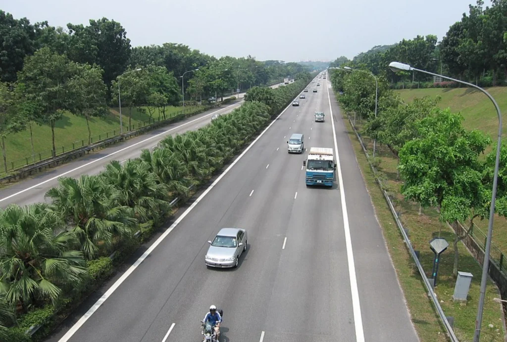
The standard speed limit on TPE is generally 90 km/h, consistent with most expressways in Singapore unless otherwise indicated, though certain sections may have temporarily reduced limits during roadworks or maintenance. Speed enforcement is carried out through fixed speed cameras and mobile speed traps, often positioned near higher-risk segments such as merging lanes and long straight stretches. Repeated speeding offences can lead to heavier penalties, including licence suspension under Singapore’s traffic regulations.
The speed limit is another detail I’d check before driving rather than assume. Even when a road has a general posted limit, restrictions can change along different sections because of roadworks or other temporary arrangements, so I’d follow the signs on the road itself rather than assume the same limit applies everywhere.
Connectivity and Route Planning
TPE connects to three major expressways, the Pan Island Expressway, the Central Expressway, and the Seletar Expressway, which lets drivers travel efficiently between eastern Singapore, the central region, and the northern corridor without passing through heavily congested arterial roads. The Defu Flyover is a notable piece of this network, facilitating traffic movement between TPE and Airport Road and playing a key role for logistics vehicles and airport-related traffic.
For commuters travelling from Buangkok to Tampines, TPE offers one of the shorter expressway routes by connecting through SLE or CTE before heading eastbound. Drivers heading from Seletar to Changi Airport can also rely on a fairly continuous expressway route via TPE, which helps minimise travel time during off-peak hours.
While researching TPE, I became more aware of how much Singapore’s expressway system is really about connections rather than individual roads. TPE links with other major expressways, so the important thing for a visitor is usually understanding which connection or exit leads toward the destination, rather than simply knowing the name of the highway. A static or interactive TPE map can help with this kind of route planning and exit identification.
Public Transport on Tampines Expressway
Although TPE is primarily designed for private and commercial vehicles, it also supports a number of bus services. Express bus routes connecting Punggol, Pasir Ris, and Tampines Interchange frequently use TPE to reduce journey time compared to regular arterial roads, and several SBS Transit and SMRT services incorporate TPE segments, particularly those linking residential estates with regional transport hubs.
Bus stops aren’t located directly along the expressway carriageway itself but sit along connected feeder roads and interchanges. If you’re relying on express bus services, I’d check a real-time arrival app and consider combining MRT and bus services where that gives a more efficient route.
My Practical Advice for Driving Around Tampines
For anyone visiting Tampines by car, I’d keep a navigation app running and check the route shortly before leaving rather than earlier in the day, since conditions can shift. If you’re heading somewhere for a fixed appointment, I’d also build in some buffer time instead of planning tightly around an exact estimated arrival.
Frequently Asked Questions
How long is the Tampines Expressway?
TPE is approximately 14 km long, stretching from Changi in the east to Seletar in the north.
What towns does TPE connect?
TPE connects Tampines, Pasir Ris, Punggol, and Seletar, and provides access to the Changi Airport area through its link with PIE.
What is the speed limit on Tampines Expressway?
The general speed limit is 90 km/h, unless otherwise stated by road signage or temporary restrictions.
Are there frequent accidents on TPE?
Like most high-traffic expressways, TPE experiences periodic accidents, particularly near merging zones and during peak congestion, though major structural incidents are uncommon.
How do I get from Tampines to Pasir Ris via expressway?
Drivers can use the eastbound section of TPE and exit toward Pasir Ris via the designated interchanges, which is generally faster than relying on smaller internal roads.
My Overall Takeaway
For me, that’s what makes TPE worth including in a Tampines guide. It’s not a sightseeing attraction, but it’s part of the infrastructure that helps connect the town with the wider eastern and north-eastern parts of Singapore. Once you understand where it fits into the road network, getting around this part of the island becomes much easier to plan.
My biggest takeaway is simple: use TPE as part of your route planning, but always check the current road conditions before you travel. Traffic information can change quickly, and a few minutes spent checking the route can make a road journey much less stressful.