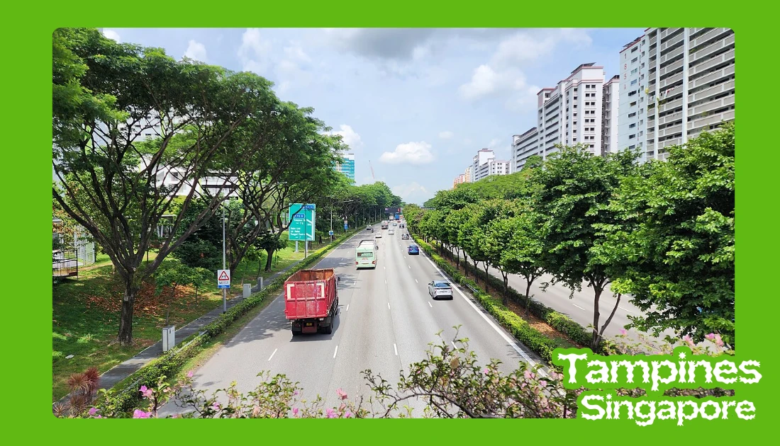
The Tampines Expressway (TPE) is a major highway in the north-eastern fringe of Singapore, forming a critical east-west transport corridor across the island. It links the Pan Island Expressway (PIE) near Changi in the east to the Central Expressway (CTE) and Seletar Expressway (SLE) in the north. For residents of Tampines, Pasir Ris, and Punggol, TPE is one of the primary expressways used for daily commuting. Drivers often use this route to reach Tampines East MRT and nearby transport hubs.
Constructed on 30 September 1987, the expressway was developed in phases. The first section was completed in June 1989, with the final stretch opened in August 1996. Today, the Tampines Expressway spans approximately 14 km and plays an essential role in supporting residential growth and airport connectivity in the region.
TPE is widely used by private motorists, logistics companies transporting goods to Changi Airport, and public bus operators serving north-eastern estates. Because it connects major towns to key employment and aviation hubs, traffic demand remains consistently high throughout peak hours.
Constructed: September 30, 1987
Length: 14 km
East end: Changi (PIE)
History: First section completed in June 1989, last section completed in August 1996
The Tampines Expressway begins near Changi, where it connects to the Pan Island Expressway (PIE), and runs westward toward Seletar. At its western end, it links directly to both the Central Expressway (CTE) and the Seletar Expressway (SLE). This configuration makes TPE a strategic connector between eastern Singapore and the northern expressway network.
Along its 14 km route, TPE serves several mature and developing residential towns. These include Tampines, Pasir Ris, Punggol, and Seletar. The expressway supports commuter flows between these estates and employment zones such as Changi Airport and industrial areas near Defu and Seletar Aerospace Park.
Key exits and interchanges are positioned to provide efficient access to surrounding towns. Major junctions include the interchange with PIE at the eastern end and the connections to SLE and CTE at the western end. The Defu Flyover, linking the Tampines Expressway to Airport Road, is another important junction facilitating industrial and airport-bound traffic.
Traffic and Accident Information
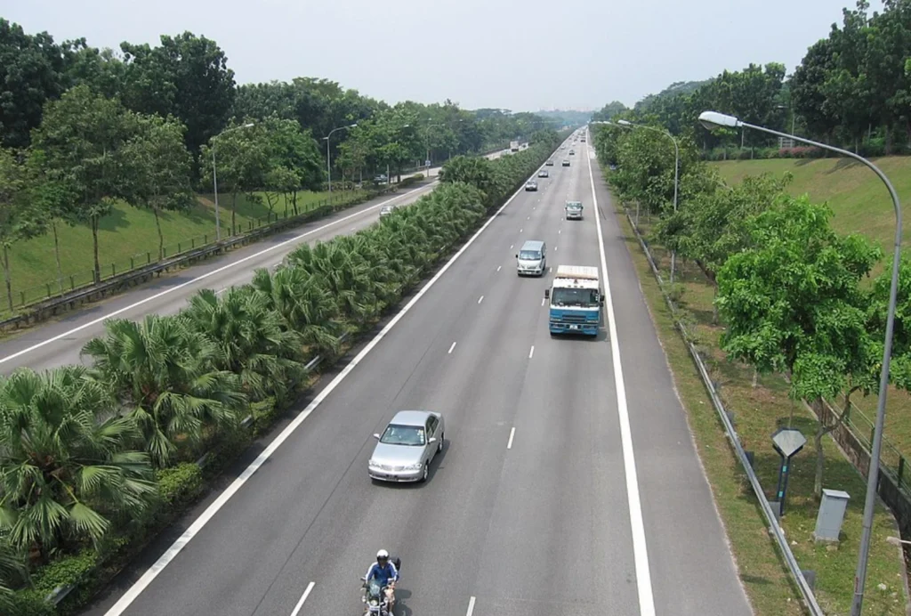
Traffic conditions on Tampines Expressway vary depending on direction and time of day. Morning peak congestion typically builds toward the PIE and airport-bound sections, while evening traffic tends to intensify toward the SLE and CTE. Interchange merging points are common bottlenecks due to lane consolidation and high vehicle volume. It also connects to residential areas like Tampines Greenvines housing development.
Accidents on TPE, including occasional fatal incidents, are generally concentrated near merging zones and during wet weather conditions. Sudden braking and high traffic density contribute to rear-end collisions. While large-scale structural incidents are rare, any reported accident on Tampines Expressway can significantly disrupt traffic flow across the north-east corridor.
Drivers are advised to monitor real-time traffic updates through official platforms such as the Land Transport Authority (LTA) and navigation apps. Maintaining safe following distances, reducing speed during rain, and avoiding abrupt lane changes are essential safety practices, especially near interchanges and flyovers.
Speed Limits & Enforcement
The standard speed limit on Tampines Expressway is generally 90 km/h, consistent with most expressways in Singapore unless otherwise indicated. Certain sections may have temporary reduced limits during roadworks or maintenance operations. Drivers should always observe posted signage along the route.
Speed enforcement is carried out through fixed speed cameras and mobile speed traps operated by traffic authorities. Enforcement zones are often positioned near high-risk segments, including merging lanes and long straight stretches where speeding is more common. Drivers exceeding the Tampines Expressway speed limit risk fines and demerit points.
Repeated speeding offences may lead to heavier penalties, including licence suspension under Singapore traffic regulations. To ensure safe travel, motorists should maintain consistent speeds, anticipate merging traffic near SLE and PIE interchanges, and avoid aggressive acceleration on open stretches of the expressway.
Connectivity & Route Maps
Tampines Expressway is connected to three major expressways: the Pan Island Expressway (PIE), the Central Expressway (CTE), and the Seletar Expressway (SLE). This multi-expressway linkage allows drivers to travel efficiently between eastern Singapore, the central region, and the northern corridor without passing through heavily congested arterial roads. Visitors can access attractions such as Tampines Eco Green nature park.
One notable infrastructure feature is the Defu Flyover, which facilitates traffic movement between TPE and Airport Road. This flyover plays a key role for logistics vehicles and airport-related traffic, reducing pressure on smaller connecting roads. The interchange design along TPE prioritises direct, high-capacity connections.
For commuters travelling from Buangkok to Tampines, TPE provides one of the shortest expressway routes by connecting through SLE or CTE before heading eastbound. Drivers heading from Seletar to Changi Airport can also rely on a continuous expressway route via TPE, minimising travel time during off-peak hours. A static or interactive Tampines Expressway map can further assist in route planning and exit identification.
Public Transport on Tampines Expressway
Although primarily designed for private and commercial vehicles, Tampines Expressway also supports multiple bus services. Express bus routes connecting Punggol, Pasir Ris, and Tampines Interchange frequently utilise TPE to reduce journey time compared to regular arterial roads.
Passengers travelling from Punggol to Tampines Interchange via expressway services benefit from shorter commute durations during non-peak hours. Several SBS Transit and SMRT bus routes incorporate TPE segments, especially those linking residential estates with regional transport hubs.
Bus stops are not located directly along the expressway carriageway but are situated along connected feeder roads and interchanges. Commuters are encouraged to check real-time arrival applications and consider combining MRT and express bus services for optimal travel efficiency.
FAQs
Frequently Asked Questions
Tampines Expressway is approximately 14 km long, stretching from Changi in the east to Seletar in the north.
What towns does TPE connect?
TPE connects Tampines, Pasir Ris, Punggol, Seletar, and provides access to the Changi Airport area through its link with PIE.
What is the speed limit on Tampines Expressway?
The general speed limit is 90 km/h unless otherwise stated by road signage or temporary restrictions.
Are there frequent accidents on TPE?
Like most high-traffic expressways, TPE experiences periodic accidents, particularly near merging zones and during peak congestion. However, major structural incidents are uncommon.
How do I get from Tampines to Pasir Ris via expressway?
Drivers can use the eastbound section of Tampines Expressway and exit toward Pasir Ris via designated interchanges, avoiding smaller internal roads for faster travel.
Conclusion
Tampines Expressway remains one of Singapore’s most important transport arteries, linking the eastern region near Changi with the northern expressway network at Seletar. Since its phased completion between 1989 and 1996, the 14 km highway has supported residential growth in Tampines, Pasir Ris, and Punggol while providing a direct corridor for airport-bound and cross-island traffic. Its integration with PIE, CTE, and SLE makes it a critical connector within the national road system.
From daily traffic patterns and congestion hotspots to speed limits and enforcement zones, understanding how TPE operates allows drivers to plan safer and more efficient journeys. While peak-hour jams and occasional accidents can impact travel times, proper route planning and adherence to speed regulations significantly reduce risk and delays.
Whether you are a motorist commuting to work, a logistics operator moving goods, or a commuter using express bus services, Tampines Expressway plays a central role in regional mobility. By staying informed about traffic updates, observing safe driving practices, and using accurate route maps, road users can maximise convenience while maintaining safety on this key Singapore expressway.